RIDE SPOT: Gurney Lane Mountain Bike Park
With quick access from the Northway connecting New York City to the Adirondacks, Gurney Lane Mountain Bike Park is a must stop ride spot.
I often find myself driving on the Northway en route to Albany, New York City, or New Jersey. The hours in the car can be a drag, but I have discovered the perfect way to break up the trip: the Gurney Lane Mountain Bike Park in Queensbury.
If you’re a mountain biker who hasn’t visited the Gurney Lane trails, I encourage you to do so next time you’re passing by. The trails lie just south of the Adirondack Park, only a few minutes from Northway Exit 20.
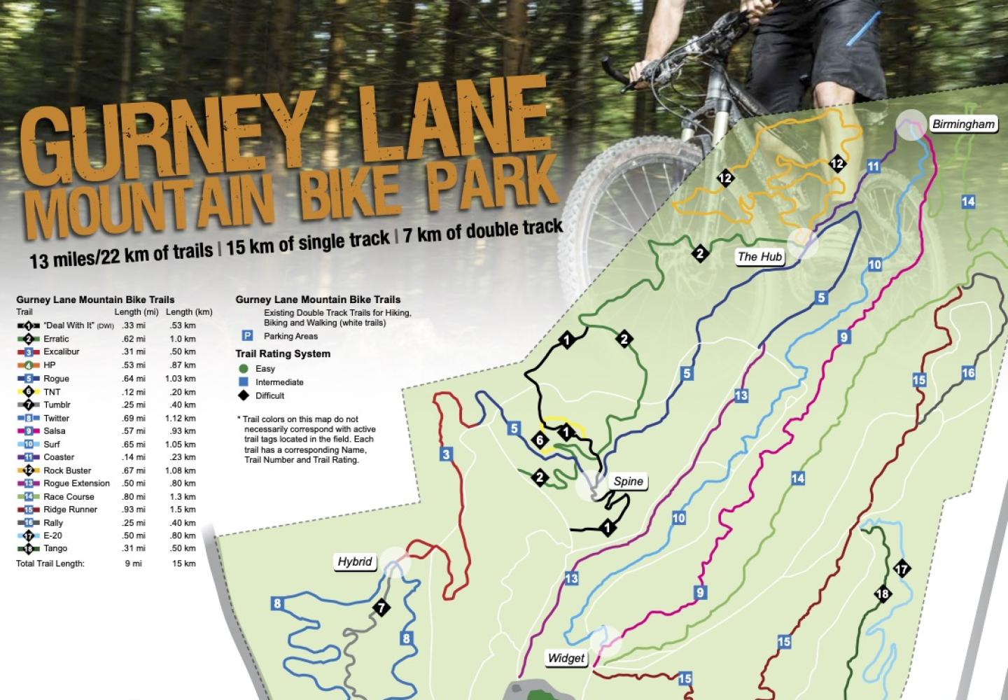
Designed and built by Steve Ovitt of Wilderness Property Management, the 13-mile network offers something to riders of all skill levels. Ovitt also designed and built a smaller network of bike trails on the neighboring Rush Pond tract, often referred to as Gurney Lane South.

Most of the trails at both locations were constructed with machines. “Machine-built trails allow the creation of environmentally sound and sustainable trails that can withstand that high level of use,” Ovitt told Bike ADK in an email. “Mini excavators can easily create large drainages and add tons of good mineral soil to the trail tread.”
All told, Ovitt’s company has designed and built 60 miles of mountain-bike trails in and around the Adirondack Park, including at North Creek, North River, Long Lake, and Brant Lake. Ovitt also designed (but did not build) the Wheelerville trails in Caroga.
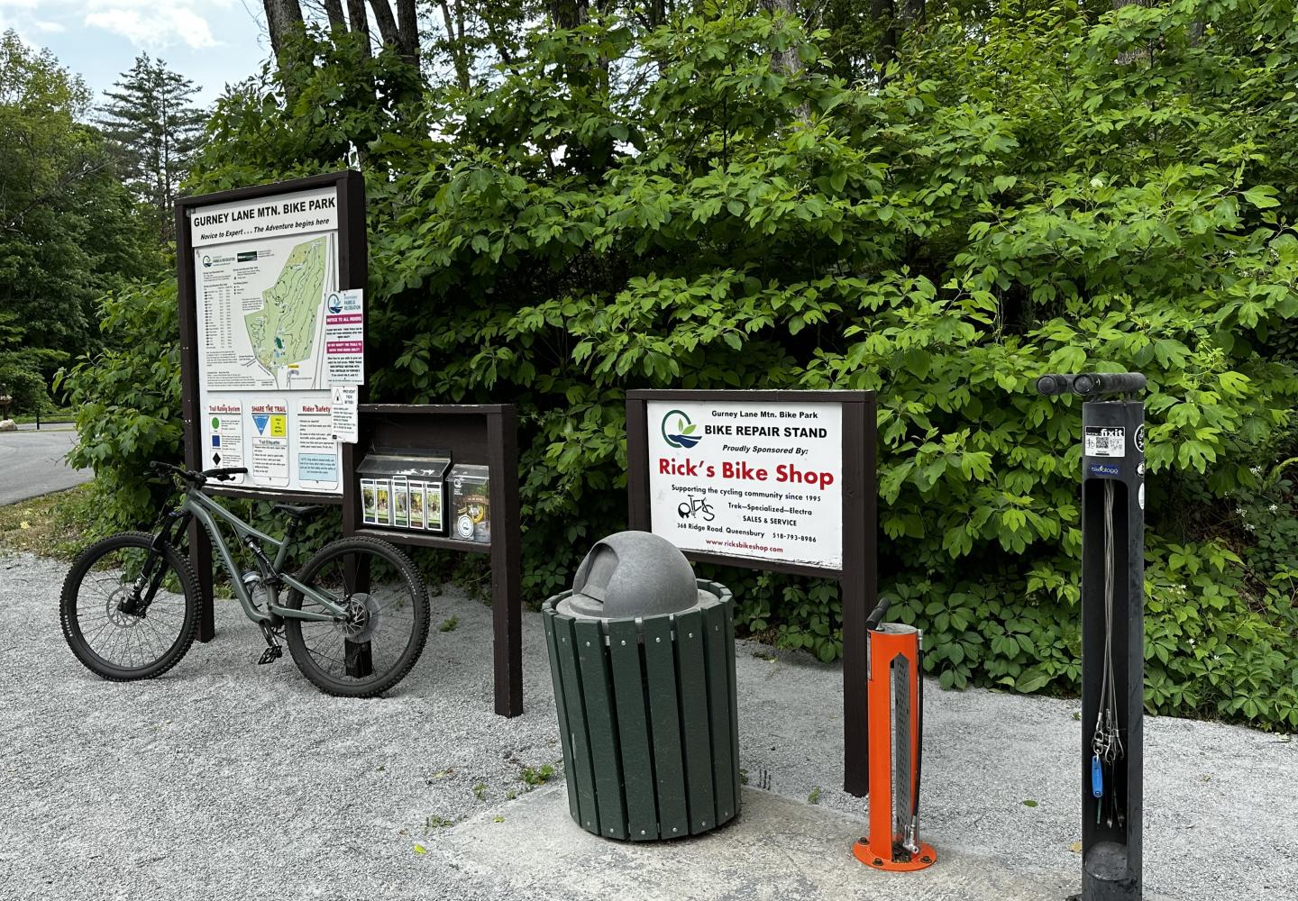
To get to the Gurney Lane Mountain Bike Park, get off the Northway at Exit 20 and then turn west onto Gurney Lane. In a minute, you’ll reach Carol Thomas Road. You could turn right here to reach a trailhead, but I prefer continuing a bit farther on Gurney Lane to another trailhead at the start of Home Page, the only easy single-track in the park. Here you’ll find a bike stand with an air pump and tools as well as a large trail map.

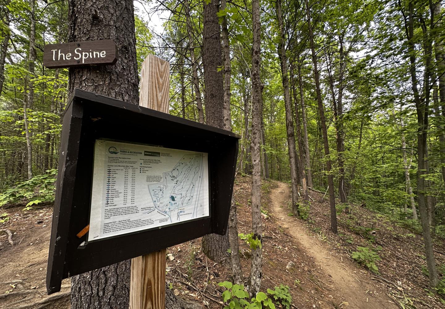
For the most part, navigating the network is a cinch. The trails are well marked, and there are maps at major junctions. You also can use the Trailforks app to check your location.
On my most recent visit, I rode 5.25 miles with 580 feet of ascent, largely on intermediate single-track trails. My route provides a good overview of the trail system. It includes the one easy trail, all or parts of nine intermediate trails, and part of one expert trail (Erratic) that intermediate riders should be able to handle. Here’s the sequence:
- Home Page. This green trail forms a lollipop loop. When you reach the start of the loop, bear left. At the next intersection bear left onto Hybrid.
- Hybrid. This blue trail also forms a loop, but take it only as far as the first intersection and then turn left onto Excalibur.
- Excalibur. Follow to an old woods road. Shortly before the road, the trail passes through a rocky section, the greatest technical challenge on the route. At the road, turn left and go a short distance to Rogue.
- Rogue. This takes you to two major junctions with maps: the Spine and the Hub. At the Hub, leave Rogue and turn onto Coaster.
- Coaster. This short downhill-only trail leads to Birmingham, another major junction.
- Salsa. At Birmingham, take the leftmost trail and follow it to its end at Widget, another major junction with a map.
- Ridge Runner. Follow it down into and up out of a ravine, then continue on the trail to its end at an intersection with Race Course.
- Race Course. Turn left onto Race Course and follow it back to Widget.
- Surf. Take this back to the Birmingham junction.
- Escalator. Short climbing trail leads back to the Hub.
- Erratic. Though labeled expert/intermediate, most of it is rather easy. Take it back to Rogue.
- Rogue. Follow this back to Excalibur.
- Excalibur. On the way back, you’ll be going uphill through the rocky section. I had to dismount.
- Hybrid. At Excalibur’s end, turn left onto Hybrid to ride the section you skipped earlier. Follow to Home Page.
- Home Page. Turn left onto Home Page to ride the section skipped earlier. This will take you through the Plunge, a big dip. At the end of the loop, turn left to return to the parking area.
Advanced riders can modify the route to include expert trails such as E-20, Tango, Rock Buster, and Crazy 8.
If you want more riding, check out the nearby Rush Pond trails. The closest parking area is at the intersection of Gurney Lane and West Mountain Road. You would have passed it on the way to the mountain-bike park (it’s on the left). From this parking area, ride on a gravel path until you reach the first bike trail, Uncas, on the right. Uncas leads downhill to Hawkeye, the longest trail (2.5 miles) in the Gurney Lane South network. From Hawkeye, you can access several other trails. I haven’t ridden them all, but those I have been on were a lot of fun and not too difficult.
During my recent ride in the bike park, I stopped at one of the junctions to study the trail map and met a local rider, Josh Mullen. I asked him how often he visited the Gurney Lane trails. “Too often,” he replied. “Whenever the kids are napping.”
If I lived in the area, I’d probably be at Gurney Lane “too often” as well. As it is, I’m glad I get to visit at least once in a while.

