Ride Report: Saratoga's Kalabus Perry Network
Find your early season mountain bike flow at Kalabus Perry located in northern Saratoga County.
As much as I enjoy biking up (sorta) and down mountain trails, I sometimes seek out a mellow trail that flows through the woods, with an emphasis on distance rather than elevation. The Flo-Rida trail is one of my go-to destinations when I’m driving to or from the Adirondacks on the Northway.
At four miles long, Flo-Rida is the main trail in the Kalabus Perry network in northern Saratoga County. Located on county land east of the Northway, the network has about 11 miles of mountain-bike trails, most of them beginner-friendly.
Kevin Ballou, who lives next to the 234-acre forest tract, started building the bike trails in 2005. Others have pitched in over the years. The Kalabus Perry volunteers are independent of the Saratoga Mountain Bike Association, which maintains a number of other bike trails in Saratoga and Rensselaer counties.
Ballou describes the KP trails as a good place for novices to learn and for experienced riders to get a quick workout. “These are flow trails, sandy, with minimal elevation changes--lots of fun but not overly challenging,” he said in an email to Bike Adirondacks.
I’ve visited the trails several times and have ridden most of them. Flo-Rida is the easiest and longest in the network, and it connects to all the other trails.
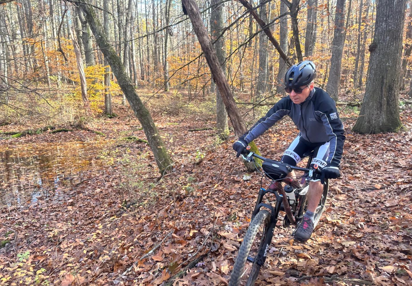
On a sunny weekday last November, I returned to Kalabus Perry with my friend Tim, a fellow retiree and longtime cyclist. There were a few other vehicles in the ample parking lot at the end of Gailor Lane in town of Northumberland.
If you haven’t been to KP before, you might think the start to Flo-Rida is on the north side of the lot, where there is a kiosk and bike stand. You can indeed start there, but for better flow, start on the south side of the lot and ride the loop clockwise.
Although the start is unmarked, it’s obvious. Look for an old school bus a short distance from the lot. Flo-Rida passes the bus on flat ground and soon takes a sharp right turn onto single-track that winds through a mostly hardwood forest.
My only complaint about Flo-Rida is that it’s sometimes hard to follow. Also known as the Orange Trail, most of it is adequately marked by signs, orange blazes, orange disks, or orange ribbon. However, some of its many intersections remain unmarked. In past visits, I have taken a wrong turn or had to stop often to get my bearings.
On this day, we had the added problem of following a trail covered with leaves. As consequence, Tim briefly got off track a few times, but nonetheless we managed to stay on Flo-Rida without veering onto a wrong trail. We did need to stop at times to check our location.
Flo-Rida’s major difficulties are tight turns, roots, and small ups and downs. I don’t recall any rocks. If there are some, they are few and far between. Novices might balk at crossing two or three long boardwalk bridges (including one with a banked curve).
Most of the uphills are short enough so that if you keep your momentum you can climb them without much effort. One exception comes about 1.5 miles into the ride, where you ascend 90 feet in a couple of switchbacks (the grade is not overly steep).
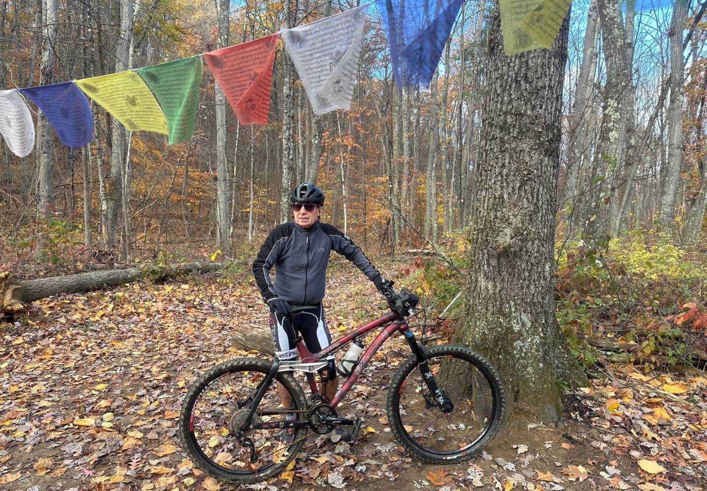
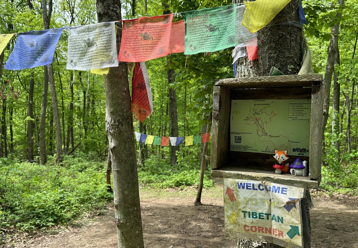
About two miles into the ride, we came to Tibetan Corner, a clearing adorned with colorful Buddhist prayer flags. No less than seven trails converge here. Check the posted map to figure out where to go next.
If you’re up for more of a challenge, you can get on the intermediate Kendrick Hill trail here. It leads uphill to the Quarry Trail, the sole expert trail in the KP network. If you’re just doing Flo-Rida, however, take a sharp right at Tibetan Corner. Your hardest riding is over: from here back to the lot, it’s mostly downhill, though with lots of twists and turns and short Buphills.
According to Trailforks, the entire Flo-Rida loop entails only 175 feet of climbing.
Afterward, I asked Tim what he thought of the trail. He sent the following message: “As a road cyclist with poor mountain-bike skills, I found Flo-Rida to be a nice rolling intermediate single-track trail that was seemingly well maintained when not covered by leaves.”
Because Flo-Rida intersects with other trails, it’s easy to extend your ride. If you want more of the same grade, check out Death Star and/or Mabel’s Trail. Each is two miles long. For something a bit harder, try the intermediate Blue Bayou, which is a mile long.
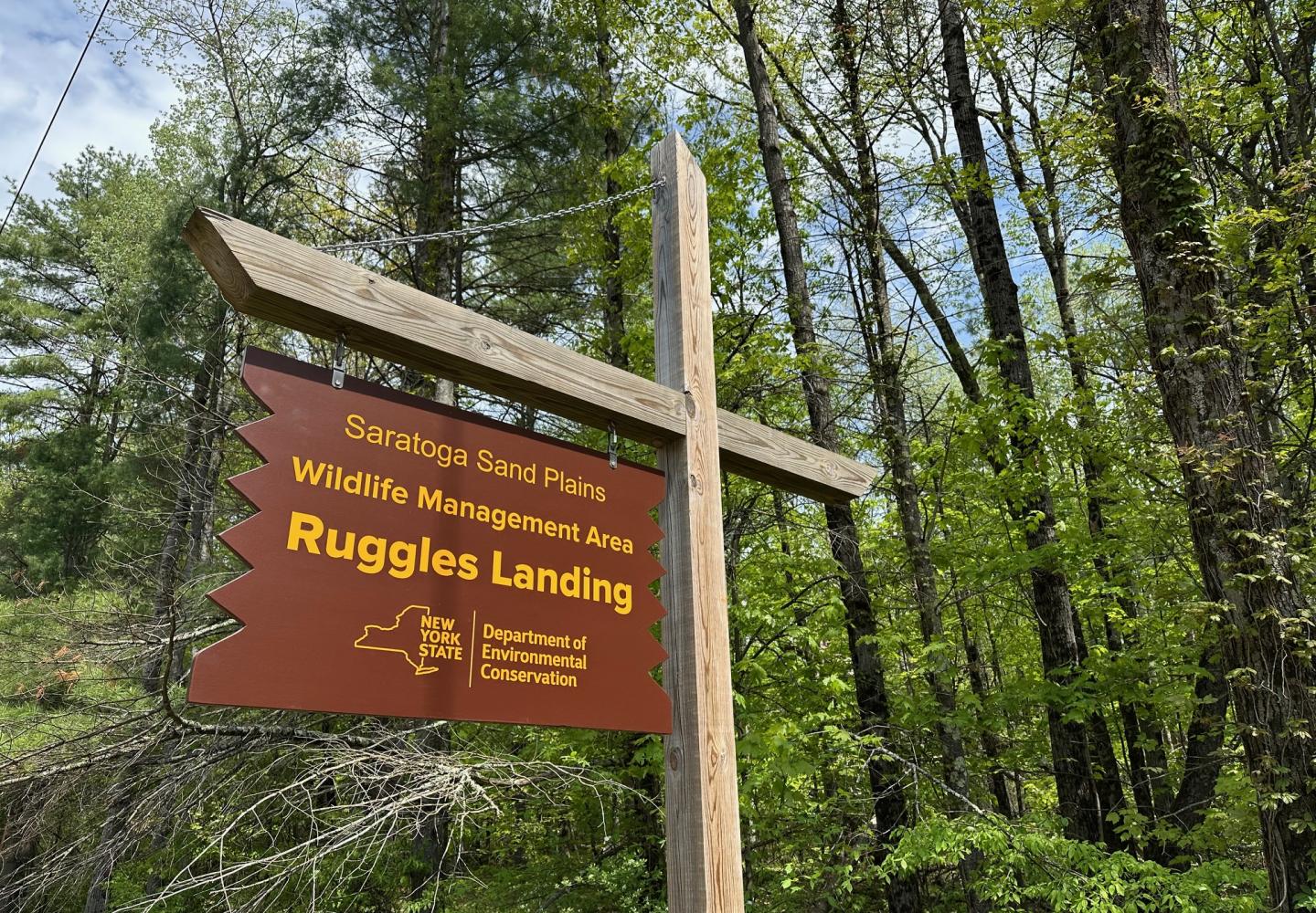
You also can ride from Kalabus Perry to bike trails in the state-owned Saratoga Sandplains Wildlife Management Area. Look for a register on Death Star on the north side of the KP tract. Follow a double-track trail north and cross Preserve Way. In another 0.2 miles, you reach a three-way junction. Turn right to bike a one-mile lollipop loop. Or go left to reach Ruggles Road in a half-mile, where there is a parking area.
Incidentally, the KP trails are good option in early spring and late fall, when Adirondack trails may be muddy or snowy. The sandy soil drains well.
To learn about another mountain-biking destination in northern Saratoga County read my earlier column about the Graphite Range Community Forest.