Make a Franklin County Gravel Route Possible?
Could resolved legal hurdles open up a spectacular 34-mile gravel route in Franklin County?
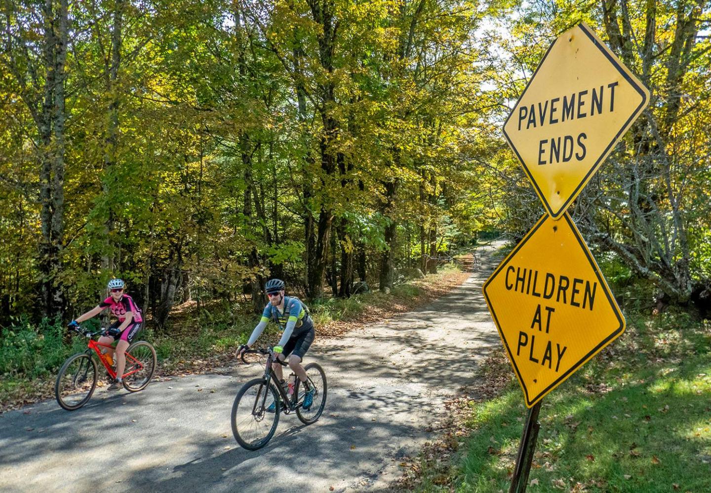
In recent years, I’ve done a fair amount of gravel biking on conservation-easement lands in the northern Adirondacks. I’ve written about some of my rides, but until now I haven’t described one of the best gravel routes in Franklin County.
That’s because it’s illegal.
Nevertheless, this seems like an opportune time to discuss this 34-mile bike loop since Franklin County is now planning for a network of long-distance multi-use trails. With luck, the county will turn the dream into reality. So let’s take an imaginary tour.
Most of the route passes through easement lands and the Forest Preserve. Except for a short stretch on state Route 458, the rest is on local roads that are little-traveled and mostly unpaved.
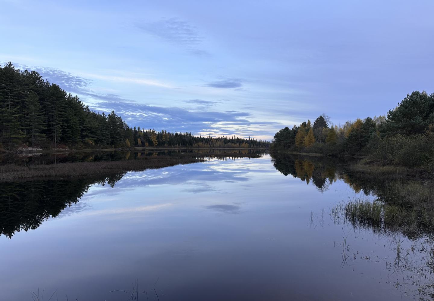
You could start almost anywhere on the loop, but let’s assume you park at the boat launch on the serene Santa Clara Flow. From there, pedal north a stone’s throw to Route 458, turn right, and go 1.7 miles along the highway’s wide shoulder to a logging road on the right.
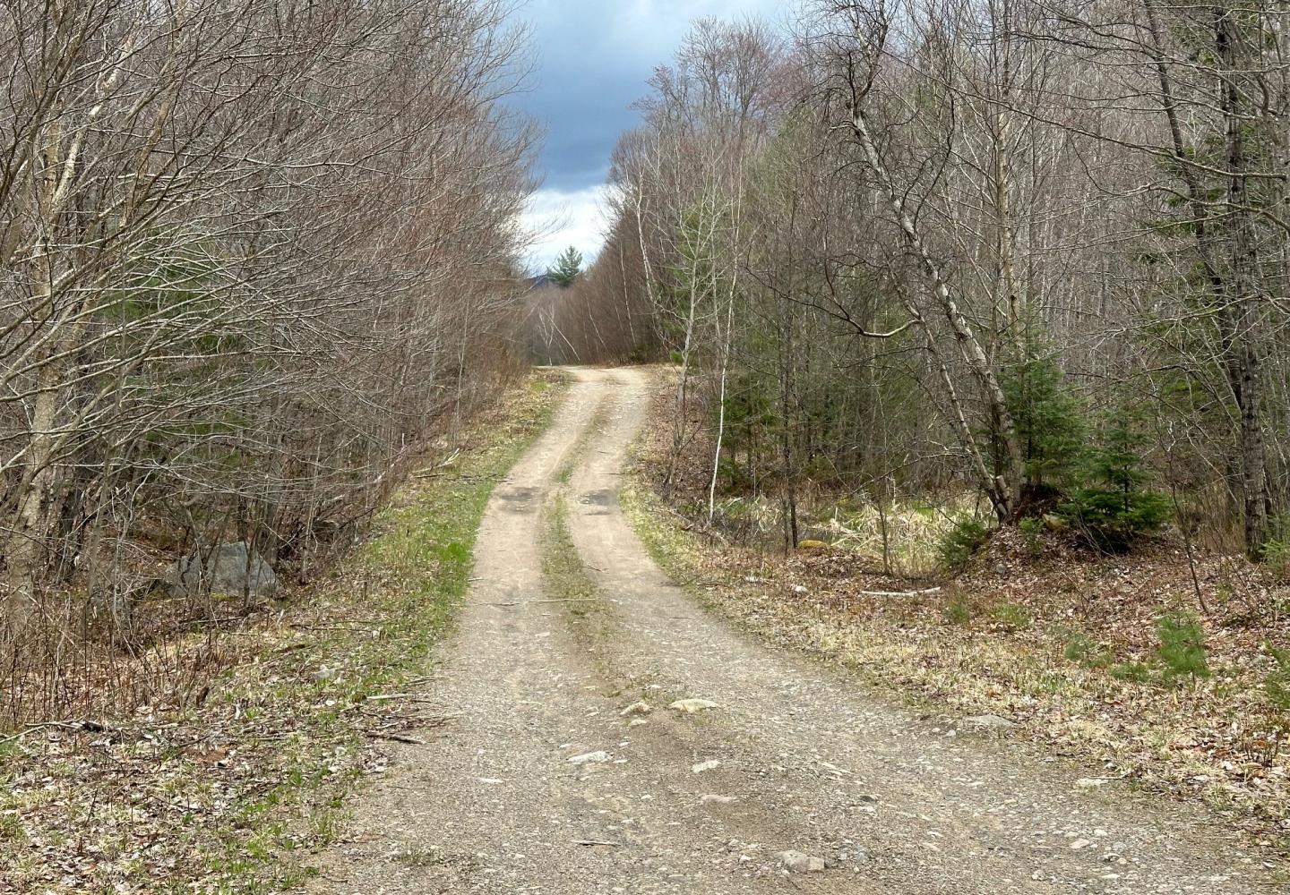
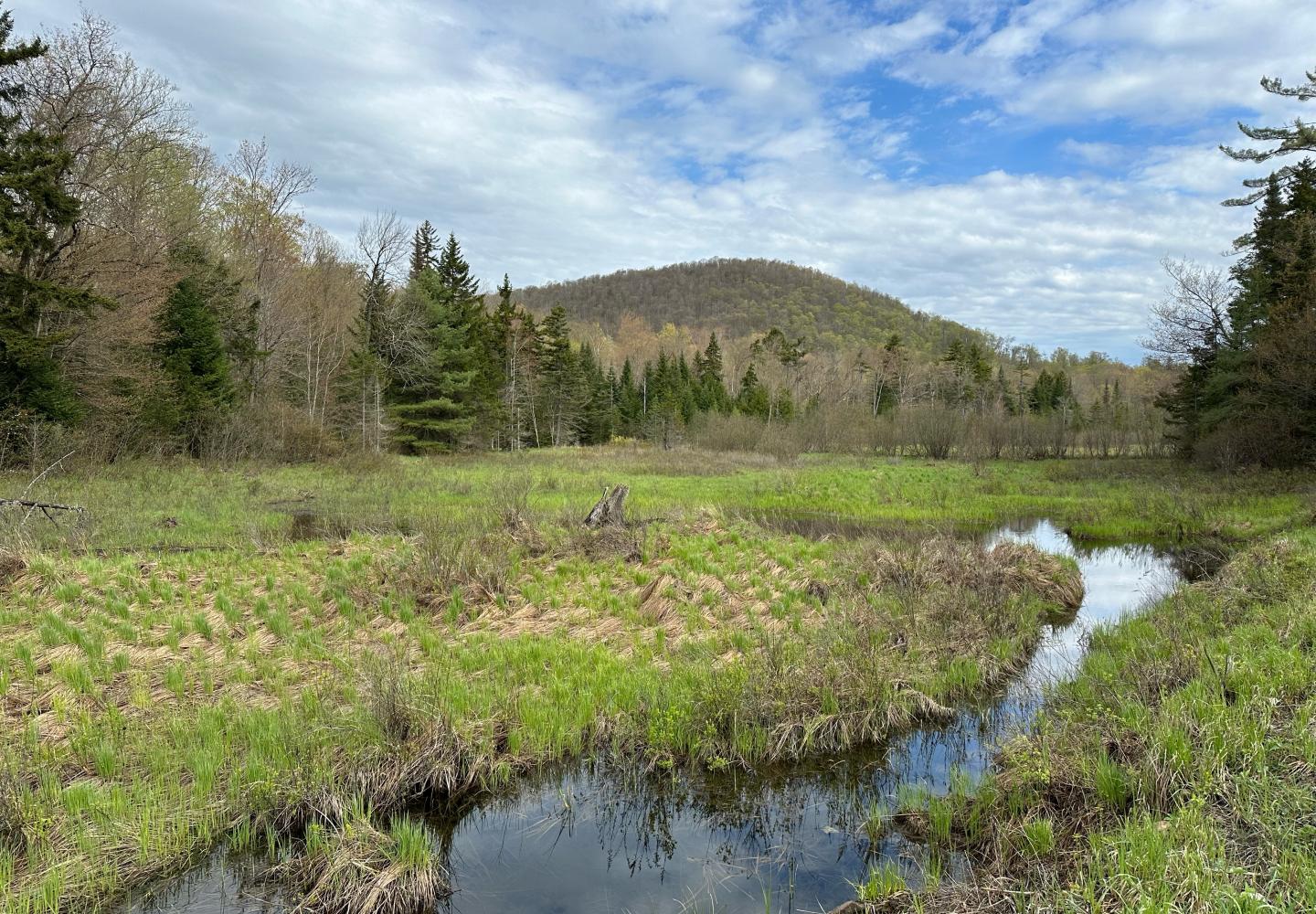
This is the Hooker Road, one of the main dirt roads on the Santa Clara easement tract. Follow it and other logging roads more than 14 miles, passing wetlands, streams, and small peaks, to a parking area for the Madawaska Flow/Quebec Brook Primitive Area.
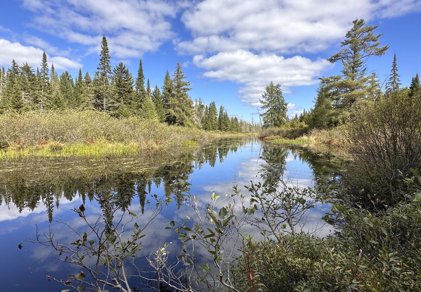
Go down a woods road a half-mile to a crossing over Quebec Brook, stopping to admire the wild brook on your right and Madawaska Flow on your left. After crossing the brook, turn left, follow a former railroad bed a mile or so, and then turn right onto another old woods road that leads to Blue Mountain Road.
At Blue Mountain Road, turn right and ride through a handsome forest, across the St. Regis River, and past Azure Mountain. After 10.7 miles, take a right onto Dexter Road and go almost three miles (mostly dirt) to a stop sign. Turn right again, and in a jiffy you’re back at the Santa Clara boat launch.
Alas, two legal complications must be resolved before gravel bikers can enjoy this route. Both involve the Madawaska Flow/Quebec Brook Primitive Area.
- The former railroad bed that bisects the Primitive Area is owned by the Spring Cove Fish & Game Club. Cyclists are not allowed on the rail bed. Nor are hikers.
- As a general rule, biking is not allowed in Primitive Areas.
These prohibitions have created a peculiar situation in which motorized use is permitted, but bicycles are not.
The woods roads in the Primitive Area and the old railroad bed are part of a snowmobile route in winter. What’s more, owners of camps on Madawaska Flow are allowed to drive through the Primitive Area to reach the rail bed.
It would be in the state’s interest to negotiate with the club to allow cyclists and hikers limited access to the railroad bed to make the connection between Madawaska Flow and Blue Mountain Road. As things stand, the Primitive Area is split into two discrete sectors, and the public cannot hike or bike from one sector to the other without trespassing.
If legal access were obtained, I hope the state Department of Environmental Conservation would see fit to amend the Primitive Area’s regulations to allow cyclists on the woods roads. It seems odd to ban bikes on roads that are used by snowmobiles and motor vehicles. Such a change would be permissible under the Adirondack Park State Land Master Plan.
Philip Hans, Franklin County’s director of economic development and tourism, told Bike Adirondacks that he will be reaching out to the Spring Cove club and DEC to see if the legal issues can be resolved. Let’s hope he succeeds.
The 34-mile loop is just one of many multi-use routes that Franklin County is looking at, but for gravel bikers, it’s one of the best. Click here for more information about the county initiative.