Ride Report: Elizabethtown LOVES Mountain Bikes
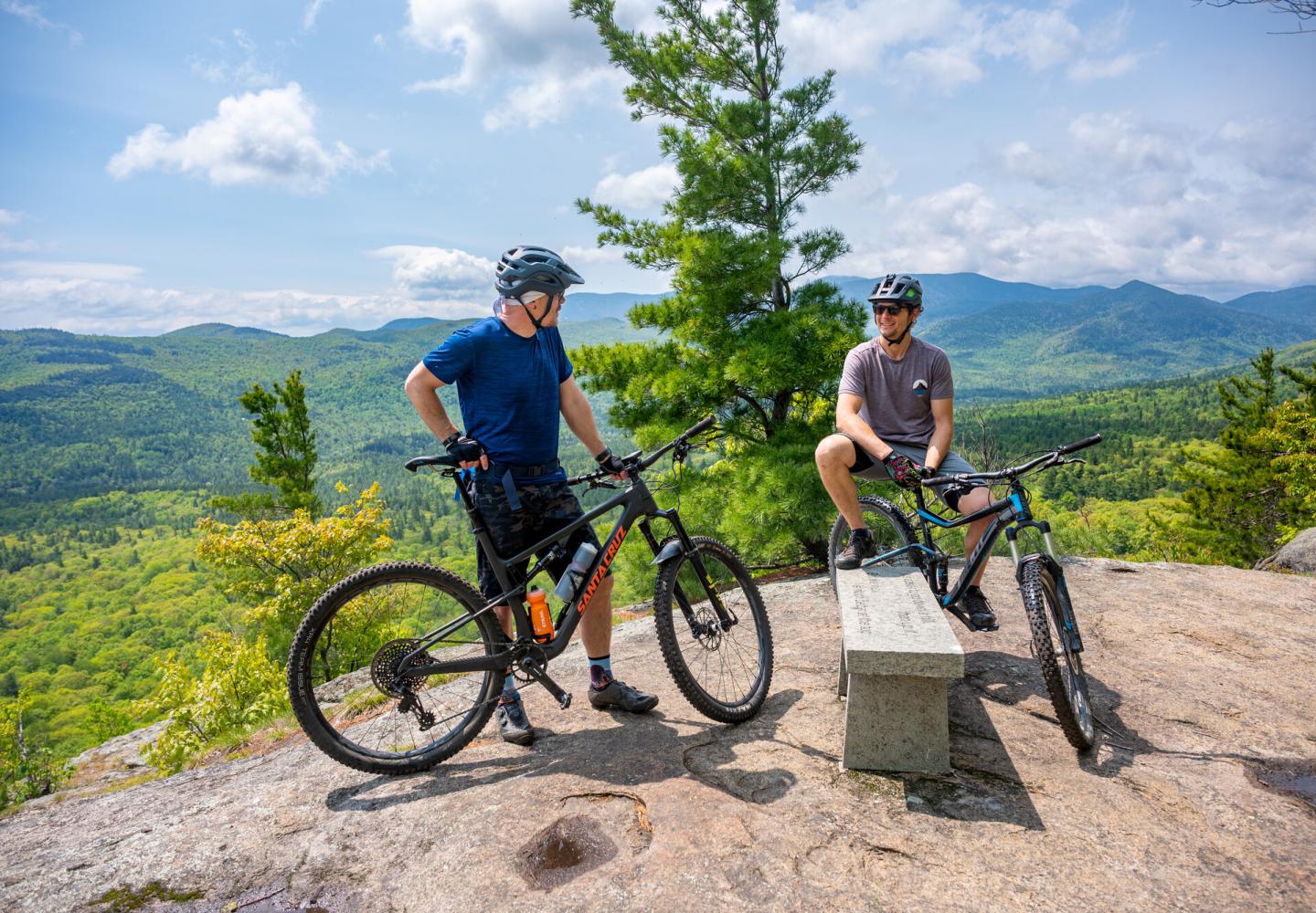
Elizabethtown must love mountain bikers. Where else can you find a trailhead hut with couch, chairs, picture windows, gas fireplace, bathroom, and bike-repair station--all this next to a pavilion with picnic tables?
And mountain bikers love E-town. The Barkeater Trails Alliance and local volunteers have built and maintain three trail networks in town: Otis Mountain, Blueberry Hill, and Cobble Hill. There also is a small network up the road at Thrall Dam Park in Lewis.
So has E-town become a mountain-biking hub?
“I think it has been one for quite some time,” observed Glenn Glover, BETA’s executive director. “It's probably more accurate to say that the community is increasingly being recognized as a mountain-biking destination and receiving the attention it deserves.
Jeff Allot, a town board member, has a lot to do with the mountain-bike vibe. Allot owns Otis Mountain and allows the public to ride on its trails for free. On Sundays, he hosts group rides known as Dirt Church. He also makes his own brand of bikes, Solace Cycles, which has a shop in town. Solace maintains the skills area at the base of Cobble Hill.
Allot helped secure a federal grant to build the trail center at Cobble Hill and did much of the work himself. The building has been open for a while, and Allot said WiFi should be available by mid-summer. In winter, it serves as a warming hut for skiers and sledders.
Here’s a brief overview of what the town has to offer:
Otis Mountain.
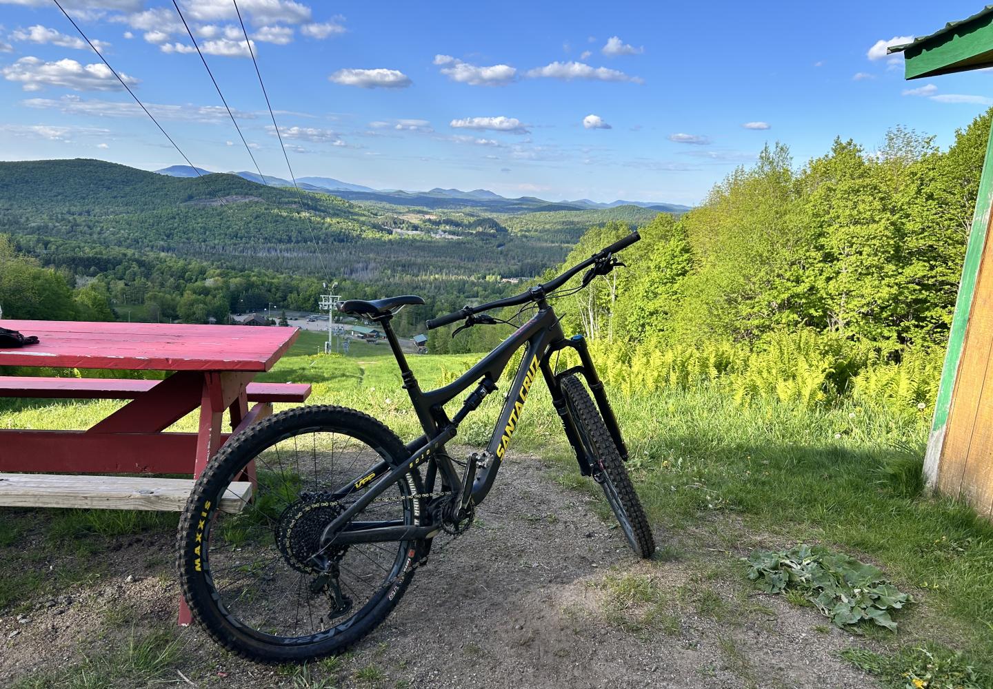
Formerly a ski hill, Allot’s property has seven miles of bike trails with some impressive views. Besides Lower Curry and Wookie Loop, there is not much for beginners. The view of the High Peaks from the California trail is worth the climb, even if you have to push your bike. (BETA is not involved in maintenance of the Otis network.)
Blueberry Hill.
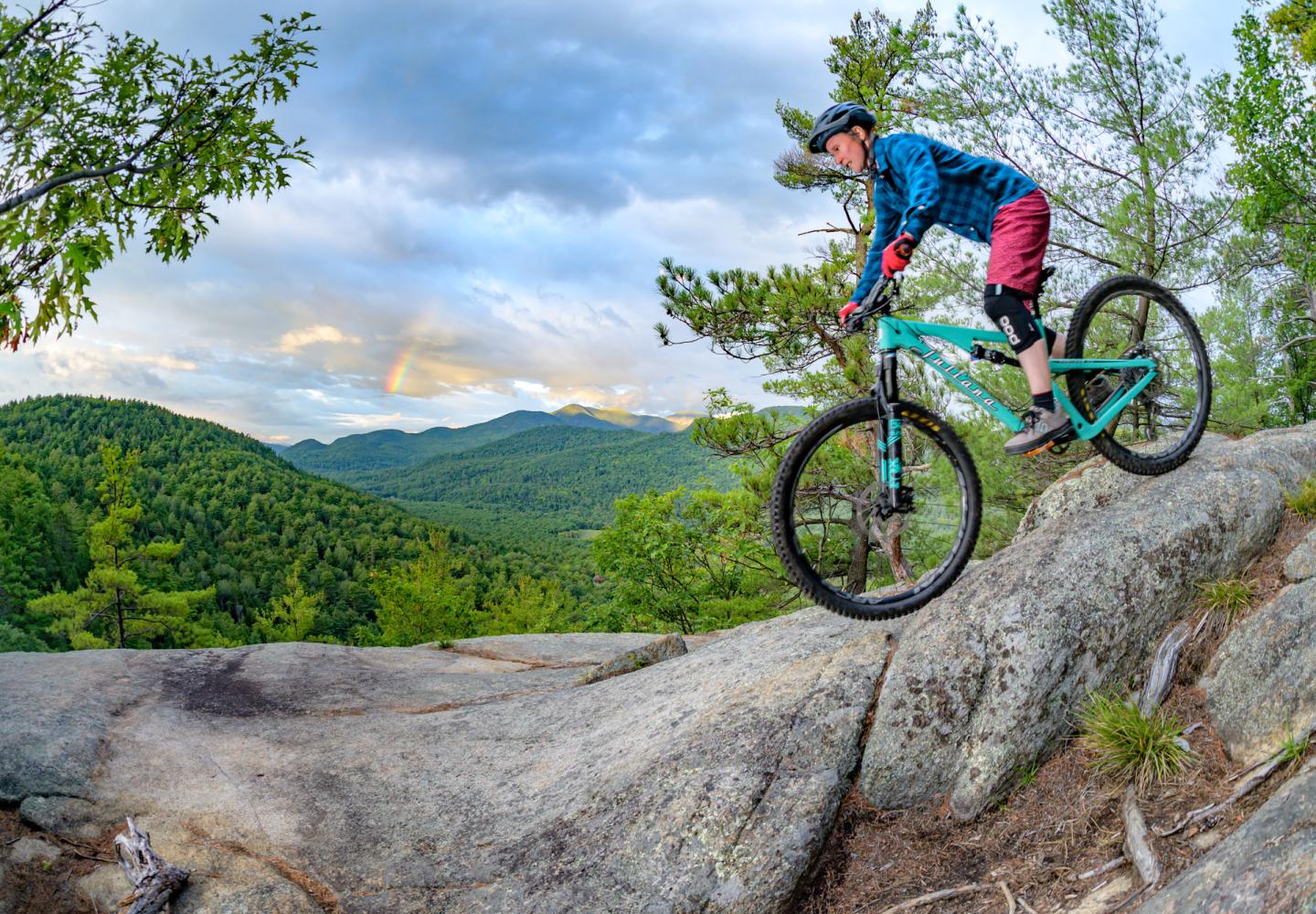
This is the largest network, with about 12 miles of trails on town land. There are trails for all skill levels, but expect some climbing. Joel’s Trail ends at a fabulous lookout. Both the Handy and Deer Leg trails are great for ascents and descents.
Cobble Hill.
BETA opened these trails in 2022. It’s the most beginner-friendly of the E-town networks. There are only about three miles of trail now, but BETA is soliciting proposals to expand and improve the system. Cobble Hill is across Route 9N from Blueberry Hill, so it’s easy to bike between the two areas.
A few weeks ago, I biked all the trails at Cobble Hill and then went over to Blueberry Hill to ride BETA’s new climbing trail, Deer Leg.
I usually bike the Cobble trails in two lollipop loops--one big, one small. The loops comprise three beginner trails and one intermediate. In June, for the sake of completeness, I also took a detour on a short expert trail. Normally, I skip this.
The Cobble Circuit
From the hut, ride through a grassy field to a dirt road on the left, just past the skills area. Turn left and climb the road to a sandy area and continue to a junction, reached in a thousand feet (all distances are measured from the hut).
Turn right onto Us or Bust, an easy double-track trail. In another 400 feet, you come to a junction with Boquet, another easy trail. Bear right to stay on Us or Bust. It climbs in a series of switchbacks, reaching a woods road in 0.5 miles. Turn right and head downhill to a field with a water tower and look for a trail on the left.
This is Cobble Hill, the intermediate trail. Now comes the hardest climb. The single-track route ascends steadily through a hardwood forest and then a stand of red pines to a junction with Hickory, an expert trail at the high point of the circuit.
If you want to try Hickory, turn left. The trail goes over a large boulder (avoidable) and then descends in several hairpins before rejoining Cobble Hill. Since I am not an expert mountain biker, I can’t get full value out of this trail. That said, my main objection is that it returns you to Cobble Hill two-tenths of a mile below the height of land, and for my money, the best part of the circuit is the long descent of the Cobble Hill trail. I returned to the high point so as not to miss any of it.
Cobble Hill descends for roughly three-quarters of a mile, leading riders through one berm turn after another (with a few straightways). There is a short climb just before the trail comes to another woods road. If you skip Hickory, this junction will be reached in 1.9 miles.
Turning left on the road, you immediately come to a four-way intersection. Go right to get on the Pleasant View trail and begin the short lollipop loop. The trail climbs briefly through a piney forest to a fork. Bear right and bike in a circle for 0.2 miles. There is no vista, but the woods are pretty. When you reach the fork again, turn right and coast back to the four-way intersection. The lollipop loop is 0.4 miles.
At the intersection, continue straight for Boquet, which climbs in switchbacks to a high point and then descends on single-track, crossing a bridge just before ending at the Us or Bust junction you passed early on.
Retrace your route back to the sandy area on the woods road. You now have two options. You could descend the road to the grassy field. Better, I think, is to veer a bit right to get on a single-track descent trail that leads to the practice area.
If you do the loop as described, skipping Hickory, you will cover 2.8 miles. If you want more miles, don’t return to the hut right away. When you get to the end of Boquet, go left on Us or Bust to return to the field with the water tower. Follow an access road from the tower to Route 9N. Cross the highway to get on Lords Road. Bike up the road a short distance and look for a parking area on the left. Climb the intermediate Handy to reach the higher trails.
BETA’s New Trail
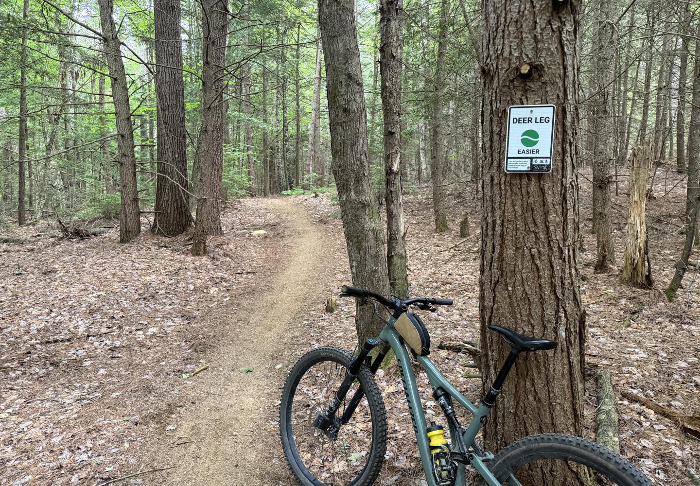
Though I visited Blueberry Hill after my tour of the Cobble, I didn’t have time for a full ride. My only mission was to bike Deer Leg, which BETA built last year. It’s a better alternative to Hemlock, an old double-track route.
I parked in the first lot on Bronson Way. From there, I started up Hemlock. In a tenth of a mile, I turned left onto Deer Leg. It’s a superb climbing trail, mostly smooth with many switchbacks. It’s a beginner trail, but the climb is long and a bit of a challenge. Toward the end, the trail dips significantly and then resumes climbing.
A mile from the lot, I reached a split in the trail. The right fork led in a short distance to the upper end of Hemlock. The left fork went to Bronson Way and the upper parking lot, where I encountered BETA volunteers who had gathered to improve the turns on Deer Leg. I thanked them for their work and then headed down..
The downhill was a blast, with many banked turns. I imagine this will become the preferred descent for those parked at the lower lot on Bronson Way.
Deer Leg is similar to the Three Sisters Trail off Hardy Road in Wilmington. Both are beginner trails that climb about a mile but present few obstacles on the descent. Three Sisters climbs 325 feet. From Bronson Way, my climb of Hemlock and Deer Leg totaled only 235 feet, yet the ascent seemed stiffer than Three Sisters. Maybe I was tired.
This year BETA will be working on the expert Joel’s Trail, a mile-long route that climbs 530 feet to an open on Blueberry Hill.
“We're undertaking significant work on Joel's Trail to address maintenance issues and enhance the riding experience.” Glover said. “Looking ahead, we'll continue to reconstruct and improve trails across both Blueberry Hill and Cobble as needs and opportunities arise.”